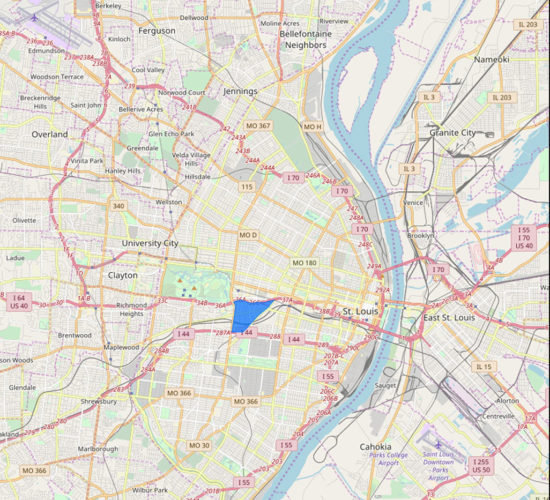
Forest Park Southeast (FPSE) is a neighborhood in the City of St. Louis bounded by Interstate 64/Highway 40 on the north; Kingshighway Boulevard to the west, the Missouri Pacific Railroad tracks on the south and Vandeventer Avenue to the east.
Forest Park Southeast is a vibrant neighborhood with a mix of single- and multi-family homes on quiet streets along with restaurants and bars in the Grove district along Manchester Avenue. FPSE comprises the four distinct neighborhoods of Adams Grove, Gibson Heights, New Boyle and Ranken East
The southern portion of the neighborhood is anchored by Adams Elementary School & Adams Park Community Center and Club, which has been operated by the Boys & Girls Club of Greater St. Louis since 2001. Immediately adjacent to the school, the Adams Community Center provides a range of services, programming, and support for neighborhood residents. The area is also home to a locally-sourced grocery story, City Greens Market, and medical services available through an Urgent Care or nearby Barnes Jewish Hospital.
The neighborhood is convenient to Washington University Medical Center, Barnes Jewish Hospital, Cortex Innovation Community, St. Louis Children’s Hospital, the Central West End, the Botanical Gardens, the Science Center and, as its name implies, Forest Park. The area is well served by bus transit and a Metrolink stop is located just a few blocks north of the neighborhood.
Travel times via car from Forest Park Southeast:
- Airport: 22 minutes
- The Zoo in Forest Park: 8 minutes
- Soulard Market: 10 minutes
- Washington University: 8 minutes
- Grant’s Farm: 22 minutes
- Scott AFB: 33 minutes
- Gateway Arch: 12 minutes
- The Galleria: 11 minutes
- Busch Stadium and the Scottrade Center: 7 minutes

